Another Final Frontier explores architectural habitats at the margins of habitability on earth by producing a site specific work on an artificial island shared between NASA and Merritt Island National Wildlife Refuge. In the shadow of explorations that abandon the planet, the project explores how nature and technology co-exist on earth.
Taking on the role of pseudo astronauts, Kitchen & Ogasian ventured out on an intense expedition which would take them to a small island they named “Grey Island – Another Final Frontier,” located fifteen minutes by kayak from the shore of Beacon 42 on Mosquito Lagoon, one of many odd islands (Spoil Islands) formed during the dredging of the Intracoastal Waterway. Grey Island sits within view of the active launch complex 39, now leased by SpaceX. Grey Island got its name simply because it had a familiarity to the greyish makeup of the moon.
Spoil islands are unexplored worlds forgotten in plain sight. The three-thousand mile string of dredged islands from New York City to Brownsville form an exceptional but ignored archipelago on the cusp of changes in climate and land use.
A frontier between land and water as well as nature and human intervention, the island serves as a test case for alternative habitats on the margins of human habitation, not on far-flung moons or planets, but here on earth, in a place that is essentially hiding in plain sight, just offshore (but harboring mainland truths). Given this context and as a mode of critical reflection, the project appropriates and modifies strategies developed by NASA to explore the lunar surface, turning those instruments and tools back onto the terrestrial and aquatic landscape of the spoil islands.
Excerpt from publication:
The first thing to be said about spoil islands is that we don’t know much about them. There is less information about this spoil island and the thousands like it that necklace the coast, then there is about the surface of the moon. Which is to say that the spoil island where we camp, where all the early indications of its submersion, along with much of the rest of the coastline, are already evident, and where you may someday visit (because it is only five hundred feet from shore), is another final frontier.
We do know that this island—the one we have named “Grey Island”—is four hundred feet in diameter. It has a ring of vegetation around its shore, some of which is native, like sabal palms and red mangroves, and some of which is considered exotic, like Brazilian pepper trees. The island’s center—like the middle of a lifesaving ring—is mostly barren. Its mound of rock and shell rises to about five feet above sea level. Over the past couple of years, we have learned other things about this island, which will serve as both tools and evidence in this exhibit and this catalogue of what the island means and what training to live here looks like.
We also know that this island has been here for about seven decades. Spoil islands, like this one, are waste products from dredging channels. The focus is on the channels, which are measured and maintained, not on the islands, which, you might say, are left to their own devices. They are cast to the side and often overlooked, if not forgotten. This chain of spoil islands through the Mosquito Lagoon was formed in the late 1920s and early 1930s, when the U.S. Army Corps of Engineers was cutting an east coast channel that would become the Intracoastal Waterway. It was a channel with a long history, part of which will be told here.
Grey Island floats in two overlapping areas—a refuge and a space center, one founded on nature and the other on technology. Both came after the bucket and pipeline dredgers had laced the lagoon and the Indian River with spoil islands. Grey Island makes up two acres of the one hundred forty thousand that NASA acquired in 1962 to expand its exploration of space, specifically its lunar landing program. Look south from the island, between palm trunks and pepper tree limbs, and you can see the Vehicle Assembly Building on the horizon. That is where engineers assembled the rockets for the Apollo missions that sent us to the moon. If there were a large enough crane, the VAB could be lifted and placed over the island like the glass cover of a bell jar.
From this vantage point here on the spoil island, we have embarked on our own mission, exploring what we don’t know and training to live in a place exceedingly far and near, a place that is remarkable and yet also quite ordinary. A place forgotten in plain sight. We have found our own landing site amid the constellation that is this three thousand mile string of islands stretching from New York to Brownsville. It is hot, the mosquitos cloud like moon dust, the ground is hard, and the sea is rising. We have traveled far into space without even leaving earth. “Another Final Frontier” explores architectural habitats at the margins of earth’s habitability.
(see publication for more text)
Process:
2018 we travelled to a number of NASA facilities in the southern United States engaged in upcoming missions to Mars. As ⅔ of the land that NASA manages sits within 16 mean feet of sea level, we were interested in how these facilities (and the people working in them) have adapted to the changing landscape and shifting coastlines, ecological management needs, weather preparedness for the centers themselves, and environmental planning. We visited HERA and HESTIA analogs at Johnson, rocket test stands at Stennis, the assembly floor at Michoud, discussed human suitability for deep space travel including studies on isolation, sleep deprivation and claustrophobia, and the management of the intracoastal waterway as it relates to the movement of rocket engines to Kennedy Space Center. We met NASA’s technical lead for Environmental Planning at KSC and Merritt Island National Wildlife Refuge where we secured a three-week residency, creating their very first such artists-in-residence.
In January, 2019 we drove our 22’ fiberglass tandem kayak over a course of 1,270 miles from Providence Rhode Island to Merritt Island, Florida. With the kayak strapped to the roof and avoiding exposed bridges, we went from snow to warm rain, arriving just in time for a Government shutdown.
We conducted an in-depth study of MINWR/KSC, Mosquito lagoon using our kayak and a variety of clunky prototype equipment. Serving as an initial reconnaissance trip, we selected an island suitable for our next phase, which would place us on the island for several days in extreme conditions; our own analog habitat, where we could carry out experiments similar to those conducted by NASA.
In June 2019, after yet another drive from RI to Florida, we set off on the final expedition. Grey Island was a 15 min kayak trip (without wind and with minimal cargo) from Beacon 42 Boat Ramp, across Mosquito Lagoon.
Our kayak was equipped with recording equipment for sound (hydrophone), video (GoPros), current speed and direction, GPS position, etc. We also designed and developed tools/methodologies inspired by manned Lunar and Mars missions used to explore and map new terrain. We constructed a habitat styled after NASA’s own analog habitats.
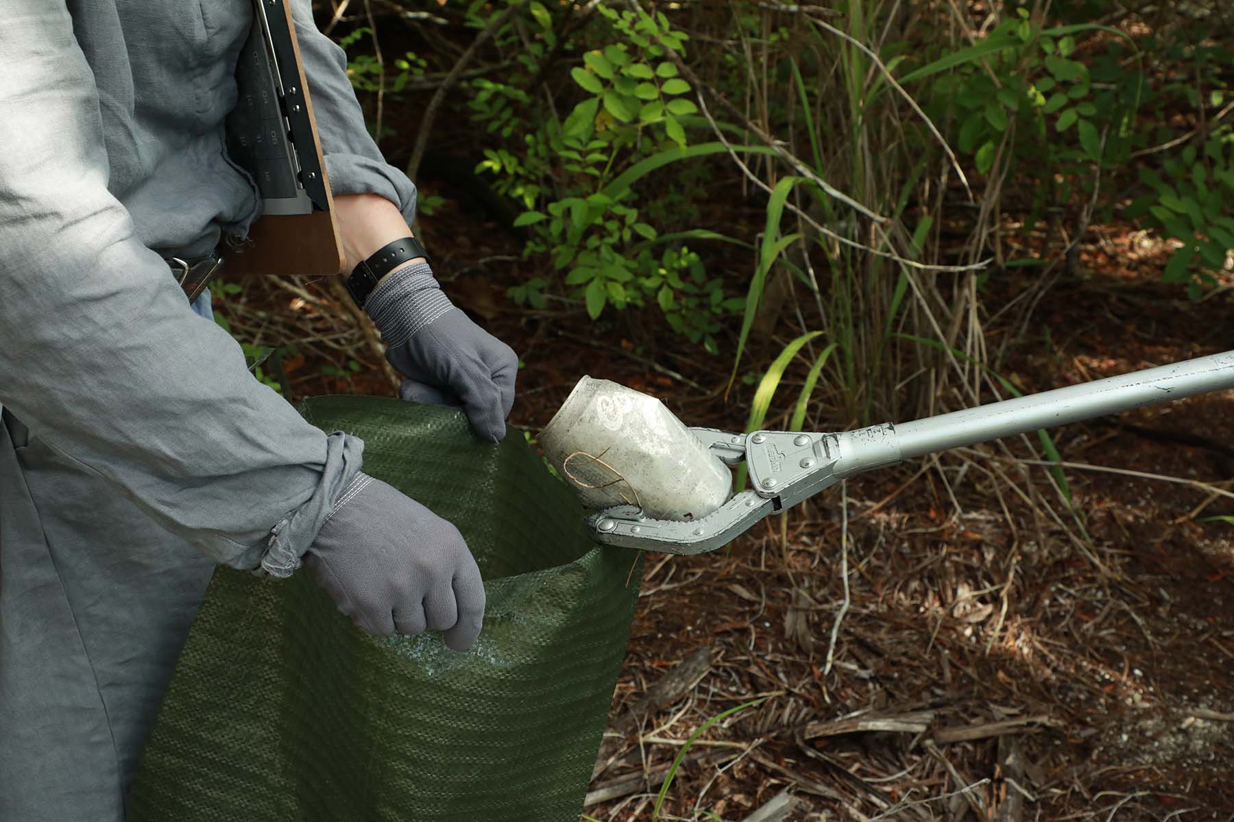
As for psychological sustainability, extreme heat, stifling humidity, an abundance of mosquitoes (“Mosquito Lagoon” was given that name for a reason), and a nest of fire ants made for quite a challenge. Rather than the planned week, we lasted a total of 4 days. We photographed our living conditions, and conducted an extended performance, meant to mimic the photographing of evidence during Lunar expeditions.
Selected Photography by Jessina Leonard. With thanks to Merritt Island National Wildlife Refuge, NASA, Selected writing by Charlie Hailey.